
Tutorial
How to build a multi-country map in PowerPoint
Select countries, add a marker for each capital, and insert the finished map into your slide.
Video, 2:22. The same steps are written out below.
What you will build
By the end you will have two slides. The first shows Belgium, the Netherlands and Luxembourg as a single map, the region usually called the Benelux. The second shows the same three countries with a marker on each capital: Brussels, Amsterdam and Luxembourg. The video takes two minutes and twenty seconds. This page covers the same ground with a little more detail, so you can follow it with the video paused, or without watching at all.
Before you start
You need GeoAddIn installed in PowerPoint for Windows and a presentation with at least two slides. Each map is placed on the slide you are looking at when you insert it. A working install adds a Geo tab to the PowerPoint ribbon. If you do not see it, the installation guide explains how to enable it.
Part 1: choose the countries
- Go to the first slide, open the Geo tab and click Multiple countries and cities. A task pane opens on the right. Everything you select for this map, countries first and then cities, is set up in that pane.
- Open the Select country drop-down and choose Belgium. Click Add selected. Belgium moves into the list of selected countries.
- Open the drop-down again, scroll down to the Netherlands and add it the same way. Then scroll back up, choose Luxembourg and add that too.
The list of selected countries now shows all three. Nothing has been drawn yet: the pane only holds your selection until you insert it.
Part 2: insert the map
Click Insert to slide. After a few seconds PowerPoint shows the three countries side by side on the slide. Each country is a separate PowerPoint shape, which is what makes the next steps, and any styling you do later, possible.
Part 3: add the capitals
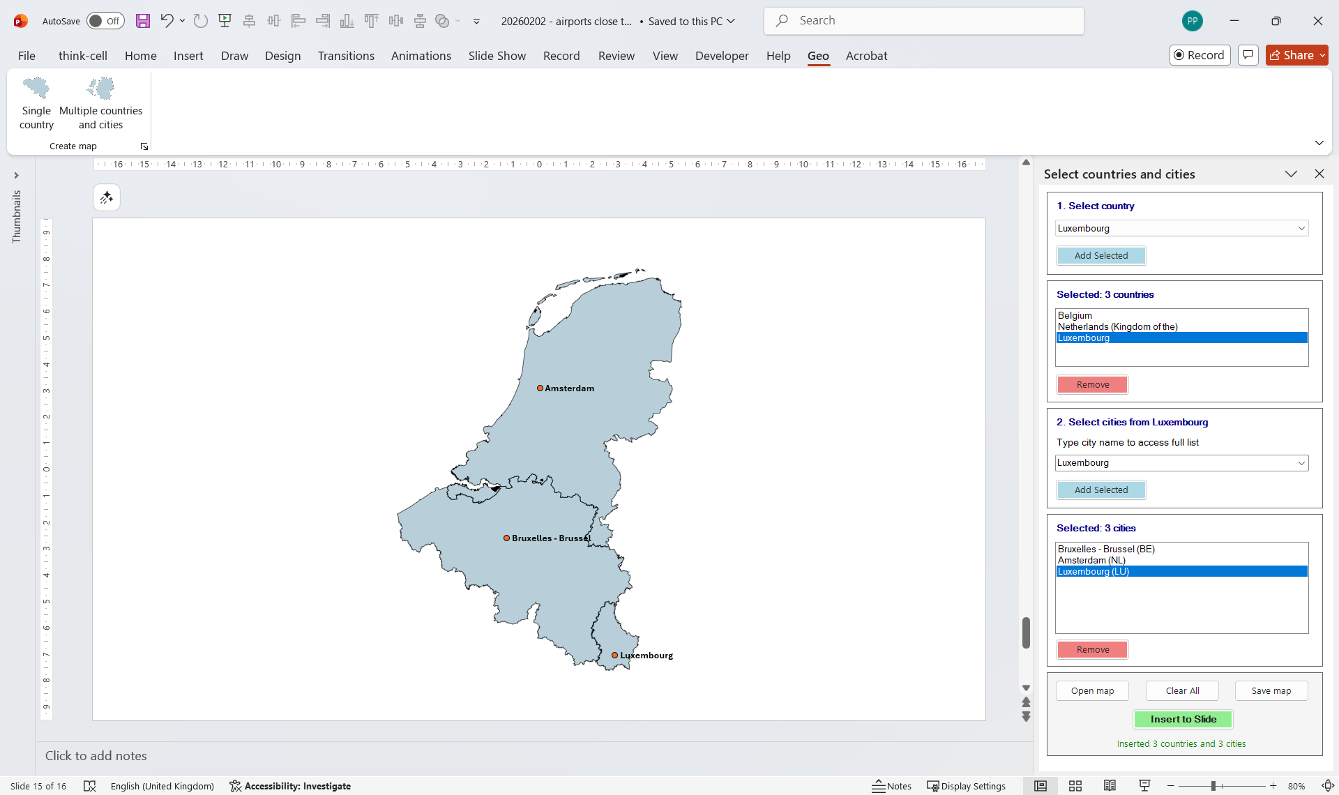
Go to the second slide. The three countries are still in the task pane, so you only need to add the cities. The city box works on one country at a time: click the country in the selected list first, then type the first letters of a city and choose it from the suggestions.
- With Luxembourg selected, type LU in the city box. Choose Luxembourg from the suggestions and click Add selected.
- Click Netherlands in the list, type AM, choose Amsterdam and click Add selected.
- Click Belgium in the list, type BR, choose Brussels and click Add selected.
- Click Insert to slide.
What you end up with
The second slide holds the three countries with a marker on each capital. Everything on it is an ordinary PowerPoint object. Click Belgium and pick a different fill colour, select Luxembourg and press Delete, or drag a marker to fine-tune where it sits. Anyone you send the file to can do the same in PowerPoint, with or without GeoAddIn. If you want to know why that matters, read what makes a PowerPoint map editable.
Ways to vary it
- Other groupings. The Nordics (Denmark, Finland, Norway and Sweden), the Baltics (Estonia, Latvia and Lithuania), or Germany, Austria and Switzerland work the same way: pick the countries, insert, then add the cities you need. Market-entry and regional-sales slides are typical uses.
- Other countries. The steps are the same for any combination. Check the coverage list to see which countries are available and at which level of detail.
- More than one city per country. Repeat the city step. The tutorial adds one capital per country only to keep the video short.
- Airports instead of cities. Airports are searchable by IATA or ICAO code in the same box. The airport tutorial shows how.
- Reusing the map. Once a selection took a while to assemble, save it and reload it in another presentation. The save and open tutorial covers that.
Looking for more? View all tutorials →
Build your own multi-country map
Start a free 14-day trial. Works with PowerPoint on Windows.
Start Free Trial